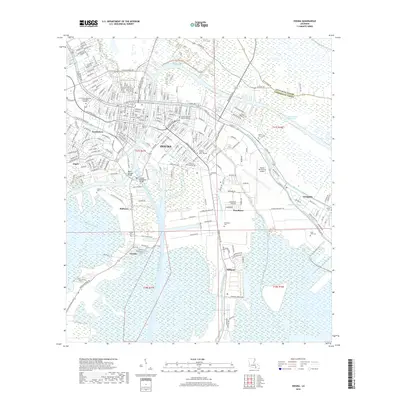
2018 Map of Houma
USGS Topo · Published 2018About this map
Houma serves as the focal point of this coastal landscape, where the Houma Navigation Canal and the Intracoastal Waterway intersect to create a vital maritime hub. The map reveals a dense network of waterways branching out from the city center, including Bayou Terrebonne and Bayou Black, which historically dictated the pattern of development. The surrounding areas like Southdown and Argyle show how residential and industrial expansion followed these natural and man-made corridors.
Find a feature on this map
52 named features on this map. Tap any name to fly to it.
Don’t see what you’re looking for? This feature index may not catch every label — zoom into the map to look around manually.
Map Details
Editions of this 2018 Houma Map
This is the sole edition of this map. No revisions or reprints were ever made.
Other maps of this area

1892 · Gibson
USGS Topo · 1:62,500

1892 · Houma
USGS Topo · 1:62,500

1894 · Bayou De Large
USGS Topo · 1:62,500

1894 · Dulac
USGS Topo · 1:62,500

1897 · Gibson
USGS Topo · 1:62,500

1932 · Houma SE
USGS Topo · 1:31,680

1932 · Houma SW
USGS Topo · 1:31,680

1932 · Houma NE
USGS Topo · 1:31,680

1932 · Houma NW
USGS Topo · 1:31,680

1935 · Theriot
USGS Topo · 1:31,680