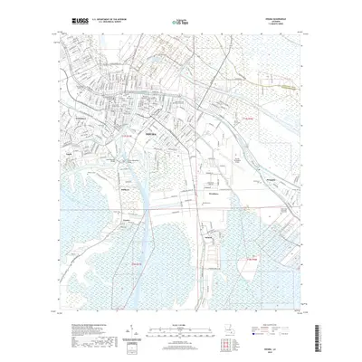
2020 Map of Houma
USGS Topo · Published 2020About this map
Houma serves as the focal point of this coastal landscape, where the Intracoastal Waterway and the Houma Navigation Canal intersect to define the region's hydraulic character. The map illustrates a dense network of water bodies, including Bayou Terrebonne and Little Bayou Black, which have historically shaped the settlement patterns of communities like Southdown, Argyle, and Mulberry. This complex intersection of natural bayous and industrial canals reflects the area's transition into a modern navigational hub while maintaining its traditional Acadian footprint.
Find a feature on this map
238 named features on this map. Tap any name to fly to it.
Don’t see what you’re looking for? This feature index may not catch every label — zoom into the map to look around manually.
Map Details
Editions of this 2020 Houma Map
This is the sole edition of this map. No revisions or reprints were ever made.
Other maps of this area

1892 · Gibson
USGS Topo · 1:62,500

1892 · Houma
USGS Topo · 1:62,500

1894 · Bayou De Large
USGS Topo · 1:62,500

1894 · Dulac
USGS Topo · 1:62,500

1897 · Gibson
USGS Topo · 1:62,500

1932 · Houma SE
USGS Topo · 1:31,680

1932 · Houma SW
USGS Topo · 1:31,680

1932 · Houma NE
USGS Topo · 1:31,680

1932 · Houma NW
USGS Topo · 1:31,680

1935 · Theriot
USGS Topo · 1:31,680