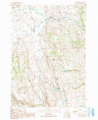
1990 Map of House Butte
USGS Topo · Published 1991About this map
The Stinkingwater Mountains rise prominently in this Harney County landscape, where the Malheur River flows through a valley defined by early ranching and rural infrastructure. Local life in the late twentieth century centered around the Drewsey Grange and the Pine Creek Sch, reflecting a sparse but established community. The map reveals an intricate network of water management, with numerous ditches and the levee along Muddy Creek supporting agricultural efforts in this arid environment.
Find a feature on this map
25 named features on this map. Tap any name to fly to it.
Don’t see what you’re looking for? This feature index may not catch every label — zoom into the map to look around manually.
Map Details
Editions of this 1990 House Butte Map
This is the sole edition of this map. No revisions or reprints were ever made.
Other maps of this area

1955 · Burns
USGS Topo · 1:250,000

1958 · Burns
USGS Topo · 1:250,000

1959 · Burns
USGS Topo · 1:250,000

1968 · Drewsey
USGS Topo · 1:62,500

1968 · Van
USGS Topo · 1:62,500

1973 · Buchanan
USGS Topo · 1:24,000
1977 · Bartlett Mtn
USGS Topo · 1:24,000
1978 · Stinkingwater Pass
USGS Topo · 1:24,000

1978 · Stinkingwater Mountains
USGS Topo · 1:100,000
1990 · Otis Mountain
USGS Topo · 1:24,000