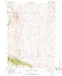
1954 Map of House Creek
USGS Topo · Published 1971About this map
The Bozeman Trail cuts through the northeast corner of this landscape, marking a legacy of mid-19th-century western migration through Johnson County. This survey, conducted shortly after the mid-century, reveals a high-plains terrain defined by complex drainage systems and the serpentine course of the Powder River at the western edge. The topography is dominated by numerous seasonal watercourses, including House Creek, Holler Draw, and Bullwhacker Creek, which carve out the arid breaks between the flats and the prominent Pine Ridge in the south. Unlike many agricultural maps, this 1954 study includes sparse signs of human settlement beyond a lone Windmill, reflecting a region largely shaped by its hydrology and traditional ranching routes. The network of draws, such as School Section Draw and Frenchman Draw, provides a fine-grained view of the natural landscape before modern development patterns could alter the cattle-country character of the area.
Find a feature on this map
16 named features on this map. Tap any name to fly to it.
Don’t see what you’re looking for? This feature index may not catch every label — zoom into the map to look around manually.
Map Details
Editions of this 1954 House Creek Map
3 editions found
Other maps of this area

1953 · Dry Fork Ranch
USGS Topo · 1:24,000

1953 · Fort Reno
USGS Topo · 1:24,000

1953 · Fort Reno SE
USGS Topo · 1:24,000

1954 · House Creek
USGS Topo · 1:24,000

1954 · Linch
USGS Topo · 1:24,000

1954 · Taylor Ranch
USGS Topo · 1:24,000

1955 · Arminto
USGS Topo · 1:250,000

1958 · Arminto
USGS Topo · 1:250,000

1961 · Soldier Creek
USGS Topo · 1:24,000

1961 · Dead Woman Crossing
USGS Topo · 1:24,000