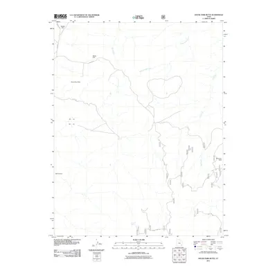
2011 Map of House Park Butte
USGS Topo · Published 2011About this map
House Park Butte rises above a high-desert plateau in San Juan County, where a complex network of seasonal watercourses and backcountry routes defines the landscape. The drainage of Salt Creek and the West Fork Salt Creek dominate the eastern half of the quadrangle, while Butler Wash carves through the north. This 2011 survey documents a remote corner of Utah where land use is dictated by natural geography, featuring high-altitude clearings like Middle Park and House Park. Access is maintained through a series of numbered forest tracks and named paths such as Beef Basin and Sweet Alice Rd, which connect isolated landmarks like Crystal Spring and Boundary Butte. The presence of these named springs and roads suggests a long-standing history of cattle ranching and resource management in this arid territory.
Find a feature on this map
28 named features on this map. Tap any name to fly to it.
Don’t see what you’re looking for? This feature index may not catch every label — zoom into the map to look around manually.
Map Details
Editions of this 2011 House Park Butte Map
This is the sole edition of this map. No revisions or reprints were ever made.
Other maps of this area

1885 · La Sal
USGS Topo · 1:250,000

1886 · Abajo
USGS Topo · 1:250,000

1892 · Abajo
USGS Topo · 1:250,000

1893 · Abajo
USGS Topo · 1:250,000

1935 · Elk Ridge
USGS Topo · 1:96,000

1940 · Elk Ridge
USGS Topo · 1:125,000

1953 · The Needles
USGS Topo · 1:62,500

1954 · Elk Ridge 1 SW
USGS Topo · 1:24,000

1954 · Elk Ridge 2 SE
USGS Topo · 1:24,000

1954 · Elk Ridge 1 NW
USGS Topo · 1:24,000