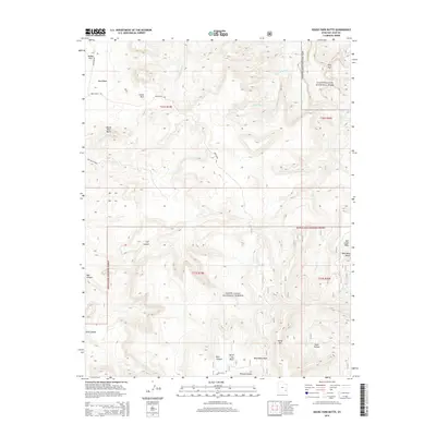
2014 Map of House Park Butte
USGS Topo · Published 2014About this map
House Park Butte dominates the central landscape of this San Juan County region, where the high desert plateaus of southeastern Utah meet the managed lands of the Manti-La Sal National Forest and Canyonlands National Park. This 2014 survey captures a vast network of drainage systems and natural landmarks, including the winding paths of Butler Wash and the W Fork Salt Cr. The terrain is characterized by deep erosional features such as Bull Canyon and Ruin Canyon, which cut through the limestone and sandstone layers to reveal the geological history of the Colorado Plateau.
Find a feature on this map
29 named features on this map. Tap any name to fly to it.
Don’t see what you’re looking for? This feature index may not catch every label — zoom into the map to look around manually.
Map Details
Editions of this 2014 House Park Butte Map
This is the sole edition of this map. No revisions or reprints were ever made.
Other maps of this area

1885 · La Sal
USGS Topo · 1:250,000

1886 · Abajo
USGS Topo · 1:250,000

1892 · Abajo
USGS Topo · 1:250,000

1893 · Abajo
USGS Topo · 1:250,000

1935 · Elk Ridge
USGS Topo · 1:96,000

1940 · Elk Ridge
USGS Topo · 1:125,000

1953 · The Needles
USGS Topo · 1:62,500

1954 · Elk Ridge 1 SW
USGS Topo · 1:24,000

1954 · Elk Ridge 2 SE
USGS Topo · 1:24,000

1954 · Elk Ridge 1 NW
USGS Topo · 1:24,000