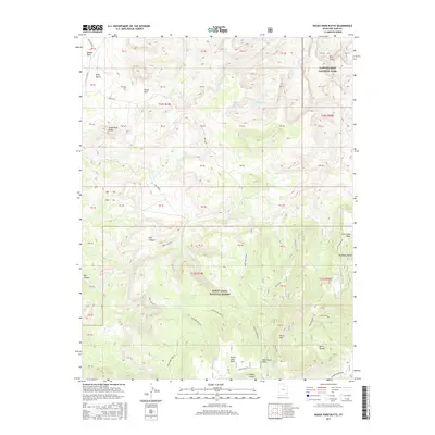
2017 Map of House Park Butte
USGS Topo · Published 2017About this map
Canyonlands National Park and the Manti-LaSal National Forest meet in this high-desert landscape, where the terrain is defined by deep drainages and prominent mesas. The presence of Ruin Canyon and the White Rim Trail E suggests a history of both ancient habitation and modern exploration. Water sources like Crystal Spring and Butler Wash are vital features in this arid environment, anchoring the geography between House Park Butte and the elevation of Horse Mtn. The map traces a network of backcountry routes, including the Ruin Park Rd and Sweet Alice Rd, which provide access to the isolated pockets of Beef Basin and Davis Pocket. This survey documents the intersection of protected federal lands and the intricate topography of Salt Creek Mesa and North Long Point.
Find a feature on this map
62 named features on this map. Tap any name to fly to it.
Don’t see what you’re looking for? This feature index may not catch every label — zoom into the map to look around manually.
Map Details
Editions of this 2017 House Park Butte Map
This is the sole edition of this map. No revisions or reprints were ever made.
Other maps of this area

1885 · La Sal
USGS Topo · 1:250,000

1886 · Abajo
USGS Topo · 1:250,000

1892 · Abajo
USGS Topo · 1:250,000

1893 · Abajo
USGS Topo · 1:250,000

1935 · Elk Ridge
USGS Topo · 1:96,000

1940 · Elk Ridge
USGS Topo · 1:125,000

1953 · The Needles
USGS Topo · 1:62,500

1954 · Elk Ridge 1 SW
USGS Topo · 1:24,000

1954 · Elk Ridge 2 SE
USGS Topo · 1:24,000

1954 · Elk Ridge 1 NW
USGS Topo · 1:24,000