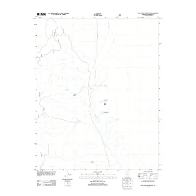
2012 Map of House Rock Spring
USGS Topo · Published 2012About this map
House Rock Wash cuts through this corner of Coconino County, serving as a central artery for drainage and navigation in a landscape defined by its remote desert springs and canyons. The presence of House Rock Spring and the nearby Signature Rock points to the historical importance of this corridor for travelers and livestock, where reliable water sources were essential for survival. This 2012 survey details a network of vital hydrologic features including Two Mile Reservoir, Twomile Spring, and Onemile Spring located along the namesake House Rock Rd. The map also captures the geographic character of the terrain through labels for Vermillion Arch and deep cuts like Burro Canyon and Trail Canyon, illustrating how the land's natural contours dictated the placement of roads and seasonal camps.
Find a feature on this map
15 named features on this map. Tap any name to fly to it.
Don’t see what you’re looking for? This feature index may not catch every label — zoom into the map to look around manually.
Map Details
Editions of this 2012 House Rock Spring Map
This is the sole edition of this map. No revisions or reprints were ever made.
Other maps of this area

1886 · Echo Cliffs
USGS Topo · 1:250,000

1886 · Kaibab
USGS Topo · 1:250,000

1891 · Echo Cliffs
USGS Topo · 1:250,000

1936 · Jacobs Lake
USGS Topo · 1:48,000

1940 · Jacob Lake
USGS Topo · 1:62,500

1953 · Jacobs Lake
USGS Topo · 1:62,500

1953 · Grand Canyon
USGS Topo · 1:250,000

1954 · Emmett Wash NW
USGS Topo · 1:24,000

1954 · Paria Plateau NW
USGS Topo · 1:24,000

1954 · Paria Plateau SW
USGS Topo · 1:24,000