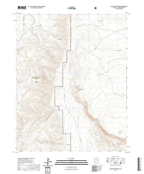
2021 Map of House Rock Spring
USGS Topo · Published 2021About this map
Kaibab National Forest dominates the western edge of this Coconino County landscape, where the high elevations of the Kaibab Plateau give way to the dramatic drop of the Vermillion Cliffs. This transition zone is defined by a series of critical water sources, including the namesake House Rock Spring, Onemile Spring, and Four Springs. These seeps were historically vital for those navigating the dry corridor of House Rock Valley between the forested plateaus and the high desert of the Paria Plateau.
Find a feature on this map
28 named features on this map. Tap any name to fly to it.
Don’t see what you’re looking for? This feature index may not catch every label — zoom into the map to look around manually.
Map Details
Editions of this 2021 House Rock Spring Map
This is the sole edition of this map. No revisions or reprints were ever made.
Other maps of this area

1886 · Echo Cliffs
USGS Topo · 1:250,000

1886 · Kaibab
USGS Topo · 1:250,000

1891 · Echo Cliffs
USGS Topo · 1:250,000

1936 · Jacobs Lake
USGS Topo · 1:48,000

1940 · Jacob Lake
USGS Topo · 1:62,500

1953 · Jacobs Lake
USGS Topo · 1:62,500

1953 · Grand Canyon
USGS Topo · 1:250,000

1954 · Emmett Wash NW
USGS Topo · 1:24,000

1954 · Paria Plateau NW
USGS Topo · 1:24,000

1954 · Paria Plateau SW
USGS Topo · 1:24,000