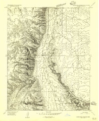
1954 Map of House Rock Spring SE
USGS Topo · Published 1956About this map
Kaibab Plateau dominates the western half of this 1950s survey, its steep escarpment dropping sharply into the lower basins to the east. This transition zone between the high forest and the arid valley floor is marked by a series of critical water sources, essential for both wildlife and the livestock industry of the era. Water management is evident through the placement of Two Mile Reservoir and the Stock Pond, alongside natural flows like Two Mile Spring and Four Mile Spring.
Find a feature on this map
14 named features on this map. Tap any name to fly to it.
Don’t see what you’re looking for? This feature index may not catch every label — zoom into the map to look around manually.
Map Details
Editions of this 1954 House Rock Spring SE Map
This is the sole edition of this map. No revisions or reprints were ever made.
Other maps of this area

1886 · Echo Cliffs
USGS Topo · 1:250,000

1886 · Kaibab
USGS Topo · 1:250,000

1891 · Echo Cliffs
USGS Topo · 1:250,000

1936 · Jacobs Lake
USGS Topo · 1:48,000

1940 · Jacob Lake
USGS Topo · 1:62,500

1953 · Jacobs Lake
USGS Topo · 1:62,500

1953 · Grand Canyon
USGS Topo · 1:250,000

1954 · Emmett Wash NW
USGS Topo · 1:24,000

1954 · Paria Plateau NW
USGS Topo · 1:24,000

1954 · Paria Plateau SW
USGS Topo · 1:24,000