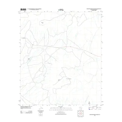
2012 Map of Housetop Mountains
USGS Topo · Published 2012About this map
The Housetop Mountains dominate this Brewster County landscape, with Housetop Mtn and Spencer Mtn anchoring a complex network of high desert drainage patterns. This 2012 survey captures a largely undeveloped expanse of West Texas where modern infrastructure is represented primarily by the east-west corridor of Highway 90. Natural gateways through the higher elevations are marked by features like Lemons Gap, while the seasonal hydrology of the region is defined by the wandering paths of Willow Cr and Dry Cr. The southern reaches of the map are particularly striking for the named topographical detail of Dagger Draw and the descriptively titled Fin Del Mundo Canyon, illustrating the remote and arid character of this portion of the Trans-Pecos.
Find a feature on this map
9 named features on this map. Tap any name to fly to it.
Don’t see what you’re looking for? This feature index may not catch every label — zoom into the map to look around manually.
Map Details
Editions of this 2012 Housetop Mountains Map
This is the sole edition of this map. No revisions or reprints were ever made.
Other maps of this area

1920 · Longfellow
USGS Topo · 1:125,000

1920 · Marathon
USGS Topo · 1:62,500

1921 · Marathon
USGS Topo · 1:62,500

1923 · Hess Canyon
USGS Topo · 1:62,500

1954 · Fort Stockton
USGS Topo · 1:250,000

1958 · Fort Stockton
USGS Topo · 1:250,000
1967 · Horse Mountain
USGS Topo · 1:24,000

1968 · Housetop Mountains
USGS Topo · 1:24,000

1968 · Tesnus
USGS Topo · 1:24,000

1968 · Cap Rock Butte
USGS Topo · 1:24,000