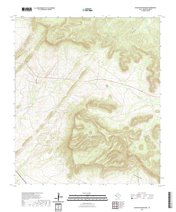
2022 Map of Housetop Mountains
USGS Topo · Published 2022About this map
The Housetop Mountains dominate the southern half of this Brewster County landscape, rising out of a terrain carved by ephemeral desert drainage systems. The northern reaches are anchored by Spencer Mtn, while the crossing of Highway 90 provides the primary east-west transit corridor through the region. This modern survey illustrates the classic West Texas topography of basins and ranges, where water—though scarce—has defined the names and shapes of the land.
Find a feature on this map
9 named features on this map. Tap any name to fly to it.
Don’t see what you’re looking for? This feature index may not catch every label — zoom into the map to look around manually.
Map Details
Editions of this 2022 Housetop Mountains Map
This is the sole edition of this map. No revisions or reprints were ever made.
Other maps of this area

1920 · Longfellow
USGS Topo · 1:125,000

1920 · Marathon
USGS Topo · 1:62,500

1921 · Marathon
USGS Topo · 1:62,500

1923 · Hess Canyon
USGS Topo · 1:62,500

1954 · Fort Stockton
USGS Topo · 1:250,000

1958 · Fort Stockton
USGS Topo · 1:250,000
1967 · Horse Mountain
USGS Topo · 1:24,000

1968 · Housetop Mountains
USGS Topo · 1:24,000

1968 · Tesnus
USGS Topo · 1:24,000

1968 · Cap Rock Butte
USGS Topo · 1:24,000