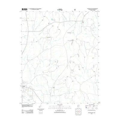
2012 Map of Houston East
USGS Topo · Published 2012About this map
The Bynum Mounds complex stands as a significant archaeological landmark along the Natchez Trace Pkwy in this area east of Houston. The terrain is defined by a dense network of waterways including Soctahoma Cr, Houlka Cr, and Bogue Culley, which cut through the landscape near notable elevations like Ross Hill and Witch Dance Hill. This landscape reflects a deep history of rural life, anchored by numerous family and community burial grounds such as Lake Cem, McKinnon Cem, and Concord Cem.
Find a feature on this map
84 named features on this map. Tap any name to fly to it.
Don’t see what you’re looking for? This feature index may not catch every label — zoom into the map to look around manually.
Map Details
Editions of this 2012 Houston East Map
This is the sole edition of this map. No revisions or reprints were ever made.
Other maps of this area

1953 · West Point
USGS Topo · 1:250,000

1956 · Tupelo
USGS Topo · 1:250,000

1958 · Tupelo
USGS Topo · 1:250,000

1958 · West Point
USGS Topo · 1:250,000

1959 · Van Vleet
USGS Topo · 1:62,500

1963 · West Point
USGS Topo · 1:250,000

1966 · Troy SE
USGS Topo · 1:24,000

1966 · Troy
USGS Topo · 1:24,000

1972 · Houlka
USGS Topo · 1:24,000
1972 · Houston West
USGS Topo · 1:24,000