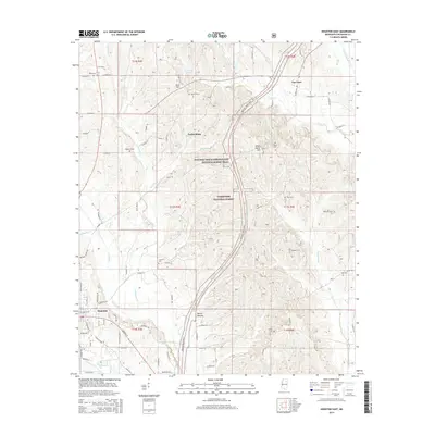
2015 Map of Houston East
USGS Topo · Published 2015About this map
Bynum Mounds and the historical corridor of the Natchez Trace Pkwy anchor this landscape in Chickasaw County, where ancient indigenous sites meet modern conservation. The eastern reaches of Houston transition into the protected woodlands of the Tombigbee National Forest, a terrain marked by prominent rises like Witch Dance Hill and Ross Hill. The map reveals a dense network of country roads connecting small settlements like Van Vleet and Parkersburg, alongside numerous family and community burial grounds including Concord Cem, Asbury Cem, and McKinnon Cem. These features, combined with the winding paths of Soctahoma Cr and Dicks Cr, illustrate a rural Mississippi landscape defined by its deep historical layers and the persistent importance of its creeks and timberlands.
Find a feature on this map
82 named features on this map. Tap any name to fly to it.
Don’t see what you’re looking for? This feature index may not catch every label — zoom into the map to look around manually.
Map Details
Editions of this 2015 Houston East Map
This is the sole edition of this map. No revisions or reprints were ever made.
Other maps of this area

1953 · West Point
USGS Topo · 1:250,000

1956 · Tupelo
USGS Topo · 1:250,000

1958 · Tupelo
USGS Topo · 1:250,000

1958 · West Point
USGS Topo · 1:250,000

1959 · Van Vleet
USGS Topo · 1:62,500

1963 · West Point
USGS Topo · 1:250,000

1966 · Troy SE
USGS Topo · 1:24,000

1966 · Troy
USGS Topo · 1:24,000

1972 · Houlka
USGS Topo · 1:24,000
1972 · Houston West
USGS Topo · 1:24,000