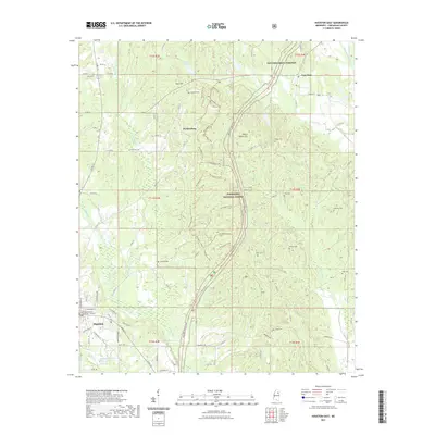
2021 Map of Houston East
USGS Topo · Published 2021About this map
The Chickasaw County Courthouse anchors the southern portion of this map, marking the county seat's role in a landscape defined by North Mississippi's timber and agricultural heritage. The Natchez Trace Parkway carves a historic corridor north-to-south, flanked by the sprawling acreage of the Tombigbee National Forest. To the north, the small settlements of Van Vleet and Parkersburg sit amidst a network of county roads that link numerous family and community burial grounds, such as Concord Cem and Ross Hill Cem.
Find a feature on this map
82 named features on this map. Tap any name to fly to it.
Don’t see what you’re looking for? This feature index may not catch every label — zoom into the map to look around manually.
Map Details
Editions of this 2021 Houston East Map
This is the sole edition of this map. No revisions or reprints were ever made.
Other maps of this area

1953 · West Point
USGS Topo · 1:250,000

1956 · Tupelo
USGS Topo · 1:250,000

1958 · Tupelo
USGS Topo · 1:250,000

1958 · West Point
USGS Topo · 1:250,000

1959 · Van Vleet
USGS Topo · 1:62,500

1963 · West Point
USGS Topo · 1:250,000

1966 · Troy SE
USGS Topo · 1:24,000

1966 · Troy
USGS Topo · 1:24,000

1972 · Houlka
USGS Topo · 1:24,000
1972 · Houston West
USGS Topo · 1:24,000