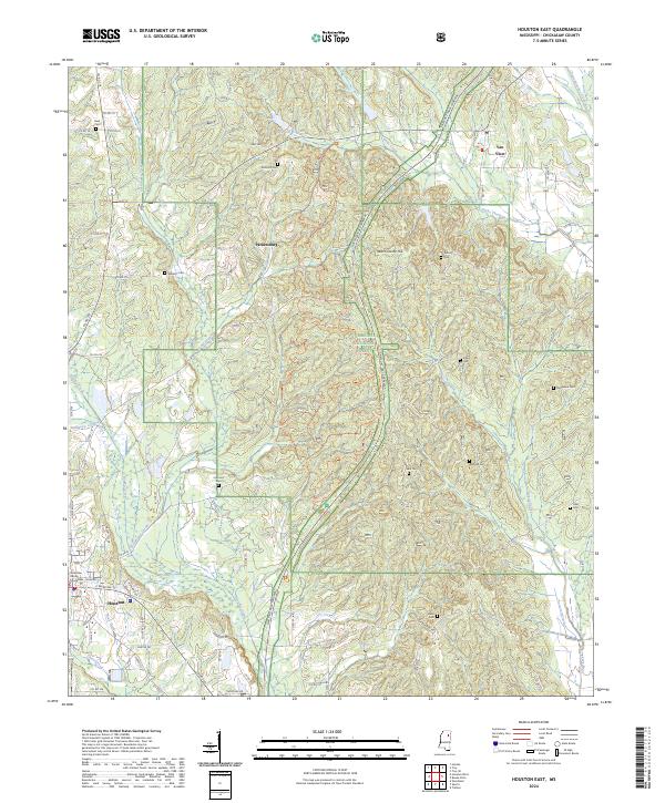
2024 Map of Houston East
USGS Topo · Published 2024About this map
The Chickasaw County Courthouse anchors the southwestern corner of this survey, marking the seat of local government where the town grid meets the rolling hills of the Tombigbee National Forest. The landscape is a mosaic of timberland and small communities like Van Vleet and Parkersburg, connected by a network of rural routes and the modern corridor of the Natchez Trace Parkway.
Find a feature on this map
85 named features on this map. Tap any name to fly to it.
Don’t see what you’re looking for? This feature index may not catch every label — zoom into the map to look around manually.
Map Details
Editions of this 2024 Houston East Map
This is the sole edition of this map. No revisions or reprints were ever made.
Other maps of this area

1953 · West Point
USGS Topo · 1:250,000

1956 · Tupelo
USGS Topo · 1:250,000

1958 · Tupelo
USGS Topo · 1:250,000

1958 · West Point
USGS Topo · 1:250,000

1959 · Van Vleet
USGS Topo · 1:62,500

1963 · West Point
USGS Topo · 1:250,000

1966 · Troy SE
USGS Topo · 1:24,000

1966 · Troy
USGS Topo · 1:24,000

1972 · Houlka
USGS Topo · 1:24,000
1972 · Houston West
USGS Topo · 1:24,000