
1975 Map of Houston
USGS Topo · Published 1977About this map
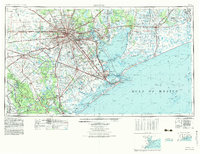
The massive urban footprint of Houston anchors this mid-1970s look at the Texas Gulf Coast, a period of rapid suburban expansion and industrial dominance. The map details the intricate network of the Houston Ship Channel and the Intracoastal Waterway, which fueled the petrochemical economy of Pasadena, Baytown, and Texas City. Landmarks of the era are clearly marked, from the Astrodome and Rice University to the Lyndon B. Johnson Space Center and Ellington Air Force Base, reflecting the city's role in space exploration and national defense.
Find a feature on this map
180 named features on this map. Tap any name to fly to it.
Don’t see what you’re looking for? This feature index may not catch every label — zoom into the map to look around manually.
Map Details
Editions of this 1975 Houston Map
2 editions found
Other maps of this area

1915 · Bellaire
USGS Topo · 1:24,000

1915 · Park Place
USGS Topo · 1:24,000

1915 · Houston Heights
USGS Topo · 1:24,000

1915 · Alief
USGS Topo · 1:24,000

1915 · Cypress
USGS Topo · 1:24,000

1915 · Deepwater
USGS Topo · 1:24,000

1915 · Katy
USGS Topo · 1:24,000

1915 · Addicks
USGS Topo · 1:24,000

1915 · Hillendahl
USGS Topo · 1:24,000

1915 · Clodine
USGS Topo · 1:24,000