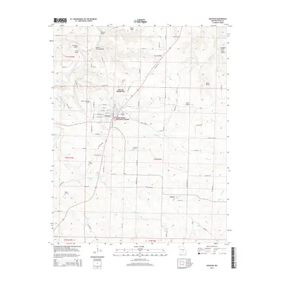
2015 Map of Houston
USGS Topo · Published 2015About this map
The town of Houston serves as the central hub of this Missouri landscape, located just east of the Big Piney River. The map reveals a town layout defined by streets like W Mill St and Chestnut St, bordered by the Houston Memorial Airport and the sprawling Mark Twain National Forest. The geography is notably shaped by numerous hollows, including Emery Hollow and Devils Hollow, which drain into the river system. For local historians, the inclusion of the County Farm Cemetery and Pine Lawn Cemetery provides significant points of reference for the community's heritage. The outskirts are dotted with smaller named localities such as Samoa and Mineral Springs City, reflecting the distributed nature of Texas County settlements. Transport routes like Cleveland Rd and the Indian Creek Trl connect these rural points across a terrain of ridges and creek branches like Hog Cr.
Find a feature on this map
126 named features on this map. Tap any name to fly to it.
Don’t see what you’re looking for? This feature index may not catch every label — zoom into the map to look around manually.
Map Details
Editions of this 2015 Houston Map
This is the sole edition of this map. No revisions or reprints were ever made.
Other maps of this area

1941 · Bado
USGS Topo · 1:62,500

1943 · Bado
USGS Topo · 1:62,500

1945 · Clear Springs
USGS Topo · 1:62,500

1948 · Clear Springs
USGS Topo · 1:62,500

1949 · Rolla
USGS Topo · 1:250,000

1951 · Licking
USGS Topo · 1:24,000

1951 · Raymondville
USGS Topo · 1:24,000

1951 · Prescott
USGS Topo · 1:24,000

1951 · Houston
USGS Topo · 1:24,000

1951 · Cabool NE
USGS Topo · 1:24,000