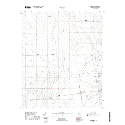
2018 Map of Houston West
USGS Topo · Published 2018About this map
The Yalobusha River winds through the western half of this Chickasaw County landscape, defining a wide floodplain that borders the small rural communities of Thorn and Pyland. To the east, the terrain transitions into more developed grounds surrounding the outskirts of Houston, where the Houston Municipal Airport and a grid of residential streets like Swine DR and Industrial DR mark the edge of the city. This 2018 survey reveals a territory shaped by its watercourses, including Fourmile Cr, Pettigrew Cr, and Chico Cr, which flow through the undulating hills toward the larger river basin. Notable for local history and genealogy researchers, the map identifies several distinct crossroads and hamlets such as Thelma in the north and Hall near the center, providing a clear record of rural settlement patterns and the extensive network of county roads that have connected these communities for generations.
Find a feature on this map
75 named features on this map. Tap any name to fly to it.
Don’t see what you’re looking for? This feature index may not catch every label — zoom into the map to look around manually.
Map Details
Editions of this 2018 Houston West Map
This is the sole edition of this map. No revisions or reprints were ever made.
Other maps of this area

1953 · West Point
USGS Topo · 1:250,000

1956 · Tupelo
USGS Topo · 1:250,000

1958 · Tupelo
USGS Topo · 1:250,000

1958 · West Point
USGS Topo · 1:250,000

1959 · Van Vleet
USGS Topo · 1:62,500

1963 · West Point
USGS Topo · 1:250,000

1966 · Troy
USGS Topo · 1:24,000

1972 · Houlka
USGS Topo · 1:24,000

1972 · Robbs
USGS Topo · 1:24,000

1972 · Atlanta
USGS Topo · 1:24,000