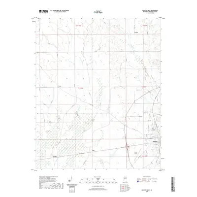
2020 Map of Houston West
USGS Topo · Published 2020About this map
The Yalobusha River and its associated wetlands dominate the western reaches of this Chickasaw County landscape, creating a broad natural corridor through which several tributaries like Mud Cr and Lick Cr flow. To the east, the terrain transitions into the upper drainage basins for Houlka Cr and Little Houlka Cr. This modern survey illustrates the rural settlement patterns of northern Mississippi, where small communities such as Thelma, Thorn, Hall, and Pyland remain centered at key road intersections. The western edge of Houston is captured here, showing the town's expansion toward the Houston Municipal Airport and Simpson Lake. The intricate network of county roads, including Co RD 405 and Co RD 345, provides a detailed look at the contemporary connectivity between these residential pockets and the primary watercourses that have historically shaped the region's agricultural and geographic identity.
Find a feature on this map
74 named features on this map. Tap any name to fly to it.
Don’t see what you’re looking for? This feature index may not catch every label — zoom into the map to look around manually.
Map Details
Editions of this 2020 Houston West Map
This is the sole edition of this map. No revisions or reprints were ever made.
Other maps of this area

1953 · West Point
USGS Topo · 1:250,000

1956 · Tupelo
USGS Topo · 1:250,000

1958 · Tupelo
USGS Topo · 1:250,000

1958 · West Point
USGS Topo · 1:250,000

1959 · Van Vleet
USGS Topo · 1:62,500

1963 · West Point
USGS Topo · 1:250,000

1966 · Troy
USGS Topo · 1:24,000

1972 · Houlka
USGS Topo · 1:24,000

1972 · Robbs
USGS Topo · 1:24,000

1972 · Atlanta
USGS Topo · 1:24,000