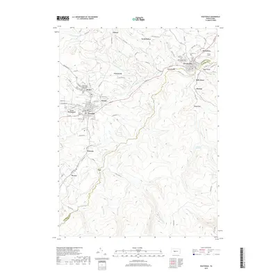
2019 Map of Houtzdale
USGS Topo · Published 2019About this map
Osceola Mills and Houtzdale serve as the primary hubs in this section of Clearfield and Centre Counties, where the landscape is defined by the winding course of Moshannon Cr. The settlement pattern follows the valley floors and higher ridges, with numerous small communities like Brisbin, Sterling, and West Moshannon clustered around the borough centers. For genealogists, the map is particularly rich in cemetery locations, documenting many denominational and fraternal burial grounds such as the Independent Order of Odd Fellows Cem and the Nativity of the Virgin Mary Orthodox Cem. South of the towns, the terrain transitions into a more forested upland, drained by Trout Run and Bear Run as they flow toward the Osceola Reservoir. The map illustrates a modern landscape still deeply influenced by its historical infrastructure, from the residential grids of Morann and Whiteside to the aviation footprint of Sankey Airport.
Find a feature on this map
110 named features on this map. Tap any name to fly to it.
Don’t see what you’re looking for? This feature index may not catch every label — zoom into the map to look around manually.
Map Details
Editions of this 2019 Houtzdale Map
This is the sole edition of this map. No revisions or reprints were ever made.
Other maps of this area

1903 · Houtzdale
USGS Topo · 1:62,500

1905 · Houtzdale
USGS Topo · 1:62,500

1920 · Altoona
USGS Topo · 1:62,500

1922 · Philipsburg
USGS Topo · 1:62,500

1922 · Altoona
USGS Topo · 1:62,500

1923 · Tyrone
USGS Topo · 1:62,500

1929 · Tyrone
USGS Topo · 1:48,000

1933 · Tyrone
USGS Topo · 1:62,500

1939 · Philipsburg
USGS Topo · 1:62,500

1944 · Houtzdale
USGS Topo · 1:24,000