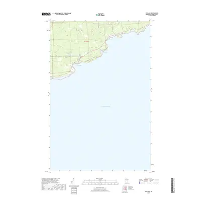
2019 Map of Hovland
USGS Topo · Published 2019About this map
Hovland anchors this stretch of the North Shore, where the terrain rises steeply from the waters of Lake Superior. The settlement is situated along Chicago Bay, a prominent coastal indentation that provided essential shelter for early maritime commerce and fishing. Just inland, the Old Settlers Cem serves as a genealogical touchstone for the families who first established roots in this wooded landscape. The shoreline is defined by a series of rocky coves and points, including Horseshoe Bay and Big Bay, each carved into the volcanic bedrock typical of the region.
Find a feature on this map
18 named features on this map. Tap any name to fly to it.
Don’t see what you’re looking for? This feature index may not catch every label — zoom into the map to look around manually.
Map Details
Editions of this 2019 Hovland Map
This is the sole edition of this map. No revisions or reprints were ever made.
Other maps of this area

1954 · Two Harbors
USGS Topo · 1:250,000

1957 · Two Harbors
USGS Topo · 1:250,000

1958 · Two Harbors
USGS Topo · 1:250,000

1958 · Hancock
USGS Topo · 1:250,000

1959 · Mineral Center
USGS Topo · 1:24,000

1959 · Tom Lake
USGS Topo · 1:24,000

1960 · Hancock
USGS Topo · 1:250,000
1960 · Farquhar Peak
USGS Topo · 1:24,000
1960 · Hovland
USGS Topo · 1:24,000
1960 · Marr Island
USGS Topo · 1:24,000