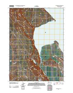
2011 Map of Howard Bay
USGS Topo · Published 2011About this map
Upper Klamath Lake dominates this 2011 survey, showing a landscape defined by water management and mountainous terrain. The eastern shoreline is marked by engineering features like the Caledonia Dike and Cross Dike, which separate the primary waters of Howard Bay from reclaimed areas and drainage networks including the Caledonia Canal. These structures reflect a long history of altering the lakeshore for agriculture and settlement, most notably seen at the Running Y Ranch development near the southern edge of the quadrangle.
Find a feature on this map
26 named features on this map. Tap any name to fly to it.
Don’t see what you’re looking for? This feature index may not catch every label — zoom into the map to look around manually.
Map Details
Editions of this 2011 Howard Bay Map
This is the sole edition of this map. No revisions or reprints were ever made.
Other maps of this area

1889 · Klamath
USGS Topo · 1:250,000

1891 · Ashland
USGS Topo · 1:250,000

1893 · Ashland
USGS Topo · 1:250,000

1894 · Klamath
USGS Topo · 1:250,000

1897 · Ashland
USGS Topo · 1:250,000

1955 · Lake O' Woods
USGS Topo · 1:62,500

1955 · Surveyor Mtn
USGS Topo · 1:62,500

1955 · Klamath Falls
USGS Topo · 1:250,000

1955 · Medford
USGS Topo · 1:250,000

1957 · Medford
USGS Topo · 1:250,000