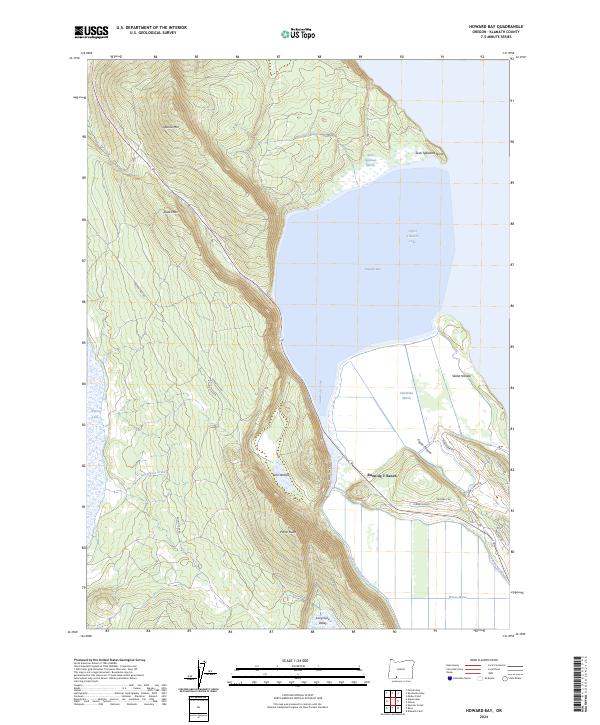
2024 Map of Howard Bay
USGS Topo · Published 2024About this map
Upper Klamath Lake defines the eastern shoreline of this region, where the water meets a complex network of wetlands and artificial waterways. The map illustrates the sophisticated water management systems required in this basin, featuring the Caledonia Canal, Wocus Drainage Canal, and the Galedonia Canal. These channels navigate through significant marshlands including Sesti Tgawaals Marsh, Caledonia Marsh, and Wocus Marsh, highlighting the reclaimed nature of the local geography.
Find a feature on this map
33 named features on this map. Tap any name to fly to it.
Don’t see what you’re looking for? This feature index may not catch every label — zoom into the map to look around manually.
Map Details
Editions of this 2024 Howard Bay Map
This is the sole edition of this map. No revisions or reprints were ever made.
Other maps of this area

1889 · Klamath
USGS Topo · 1:250,000

1891 · Ashland
USGS Topo · 1:250,000

1893 · Ashland
USGS Topo · 1:250,000

1894 · Klamath
USGS Topo · 1:250,000

1897 · Ashland
USGS Topo · 1:250,000

1955 · Lake O' Woods
USGS Topo · 1:62,500

1955 · Surveyor Mtn
USGS Topo · 1:62,500

1955 · Klamath Falls
USGS Topo · 1:250,000

1955 · Medford
USGS Topo · 1:250,000

1957 · Medford
USGS Topo · 1:250,000