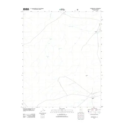
2012 Map of Howard Hill
USGS Topo · Published 2012About this map
Willaha and the surrounding high desert of Coconino County are defined by a network of seasonal water catchments and drainage ways in this 2012 survey. The landscape is dominated by ephemeral features like Coconino Wash and Rain Tank Wash, which demonstrate the critical importance of water management in this arid region. Named infrastructure for livestock or local transit, such as Dust Bowl Tank, Buck Tank, and West Pasture Tank, are scattered across the terrain, connected by the Willaha Co Rd and various forest routes. To the north, the small settlement of Woodin sits near Jackson Tank, while the prominent rise of Howard Hill serves as a central landmark. This map illustrates the intersection of ranching history and modern geographic naming, where every depression and pond, like Red Dike Pond, is precisely documented for navigation and land use.
Find a feature on this map
15 named features on this map. Tap any name to fly to it.
Don’t see what you’re looking for? This feature index may not catch every label — zoom into the map to look around manually.
Map Details
Editions of this 2012 Howard Hill Map
This is the sole edition of this map. No revisions or reprints were ever made.
Other maps of this area

1886 · Chino
USGS Topo · 1:250,000

1891 · Chino
USGS Topo · 1:250,000

1948 · Williams
USGS Topo · 1:250,000

1954 · Williams
USGS Topo · 1:250,000

1956 · Williams
USGS Topo · 1:250,000

1960 · Williams
USGS Topo · 1:250,000

1961 · Williams
USGS Topo · 1:250,000

1962 · Valle
USGS Topo · 1:62,500
1979 · Box K Ranch
USGS Topo · 1:24,000

1979 · Little Harpo Canyon
USGS Topo · 1:24,000