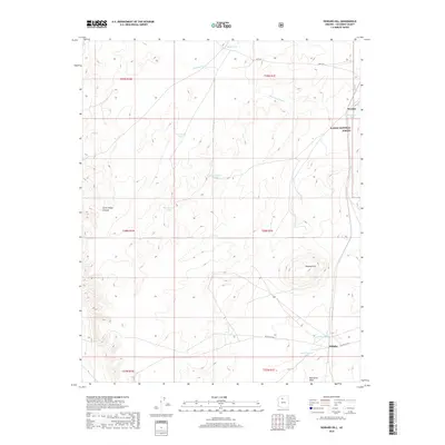
2018 Map of Howard Hill
USGS Topo · Published 2018About this map
Willaha and Woodin anchor this high-plateau landscape, characterized by the critical infrastructure of livestock tanks and seasonal drainage systems in the late 2010s. The terrain is defined by the prominent Howard Hill and the winding course of Coconino Wash, which flows through the northern reaches of the quadrangle. As much of the eastern portion is protected within the Kaibab National Forest, the map reveals a land management pattern reliant on isolated water sources like Jackson Tank and West Brown Tank.
Find a feature on this map
23 named features on this map. Tap any name to fly to it.
Don’t see what you’re looking for? This feature index may not catch every label — zoom into the map to look around manually.
Map Details
Editions of this 2018 Howard Hill Map
This is the sole edition of this map. No revisions or reprints were ever made.
Other maps of this area

1886 · Chino
USGS Topo · 1:250,000

1891 · Chino
USGS Topo · 1:250,000

1948 · Williams
USGS Topo · 1:250,000

1954 · Williams
USGS Topo · 1:250,000

1956 · Williams
USGS Topo · 1:250,000

1960 · Williams
USGS Topo · 1:250,000

1961 · Williams
USGS Topo · 1:250,000

1962 · Valle
USGS Topo · 1:62,500
1979 · Box K Ranch
USGS Topo · 1:24,000

1979 · Little Harpo Canyon
USGS Topo · 1:24,000