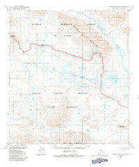
1984 Map of Howard Pass A-1
USGS Topo · Published 1984About this map
National Petroleum Reserve in Alaska dominates the northern half of this Brooks Range landscape, meeting the boundary of the Noatak National Preserve at a time of significant federal land reclassification. Published shortly after the 1980 Alaska National Interest Lands Conservation Act, the map delineates the Noatak Wilderness as it protects the headwaters and drainage of the Etivluk River. The terrain is defined by high passes and mountain summits, including Inyorurak Pass and the prominent Koiyaktot Mountain. Unlike more settled regions, the geography here is exclusively natural, marked by glacial features like Etivlik Lake and Kikitaliorak Lake. The absence of roads or permanent structures reflects the era's focus on conservation and scientific study within the North Slope Borough.
Find a feature on this map
15 named features on this map. Tap any name to fly to it.
Don’t see what you’re looking for? This feature index may not catch every label — zoom into the map to look around manually.
Map Details
Editions of this 1984 Howard Pass A-1 Map
This is the sole edition of this map. No revisions or reprints were ever made.
Other maps of this area

1951 · Survey Pass
USGS Topo · 1:250,000

1951 · Howard Pass
USGS Topo · 1:250,000

1951 · Ambler River
USGS Topo · 1:250,000

1951 · Killik River
USGS Topo · 1:250,000

1956 · Survey Pass
USGS Topo · 1:250,000

1956 · Howard Pass
USGS Topo · 1:250,000

1956 · Killik River
USGS Topo · 1:250,000

1956 · Ambler River
USGS Topo · 1:250,000

1964 · Survey Pass
USGS Topo · 1:250,000

1964 · Ambler River
USGS Topo · 1:250,000