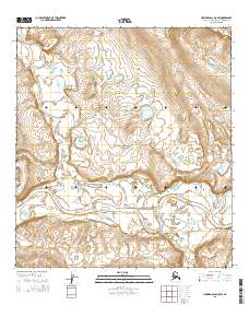
2015 Map of Howard Pass A-5 SW
USGS Topo · Published 2015About this map
The Noatak River dominates this landscape within the Noatak National Preserve, showing the wild, braided drainage patterns of the Alaskan Arctic. In this 2015 U.S. Geological Survey representation, the primary river valley serves as the central artery for the region's hydrology, joined by several significant tributaries. From the north, the Anisak River winds through the tundra before reaching its confluence with the Noatak, while smaller waterways like Itimtikrak Cr and Namidlik Cr drain the surrounding slopes. The map is devoid of permanent settlements or roads, instead focusing on the complex natural topography and the official township and range boundaries that define this protected wilderness. For researchers, it offers a precise record of the river's course and the intricate creek networks that shape the environment of the Northwest Arctic Borough.
Find a feature on this map
13 named features on this map. Tap any name to fly to it.
Don’t see what you’re looking for? This feature index may not catch every label — zoom into the map to look around manually.
Map Details
Editions of this 2015 Howard Pass A-5 SW Map
This is the sole edition of this map. No revisions or reprints were ever made.
Other maps of this area

1951 · Baird Mountains
USGS Topo · 1:250,000

1951 · Howard Pass
USGS Topo · 1:250,000

1951 · Ambler River
USGS Topo · 1:250,000

1951 · Misheguk Mountain
USGS Topo · 1:250,000

1956 · Howard Pass
USGS Topo · 1:250,000

1956 · Ambler River
USGS Topo · 1:250,000

1956 · Misheguk Mountain
USGS Topo · 1:250,000

1956 · Baird Mountains
USGS Topo · 1:250,000

1964 · Ambler River
USGS Topo · 1:250,000

1965 · Baird Mountains
USGS Topo · 1:250,000