
1956 Map of Baird Mountains
USGS Topo · Published 1965About this map
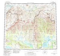
The Noatak River dominates this northern Alaskan interior, carving through the massive Baird Mountains and into the dramatic Grand Canyon. This mid-century survey captures a complex drainage system where the Squirrel River and its numerous tributaries, including Klery Creek and Bear Creek, flow through the southern foothills. The landscape is defined by its dramatic relief, from the Isacheluich Mountains in the north to the Kallichuk Hills and Ikana Hills near the southern coast. Notable peaks such as Deviation Peak and Nakolik Mtn serve as significant landmarks within the trackless terrain. The presence of several distinct canyons, including Noatak Canyon, highlights the significant fluvial erosion that has shaped this region over millennia, while the clustering of lakes like Lake Kangilipak and Lake Tulugak marks the glacial history of the Brooks Range periphery.
Find a feature on this map
44 named features on this map. Tap any name to fly to it.
Don’t see what you’re looking for? This feature index may not catch every label — zoom into the map to look around manually.
Map Details
Editions of this 1956 Baird Mountains Map
7 editions found
Other maps of this area

1951 · De Long Mountains
USGS Topo · 1:250,000

1951 · Baird Mountains
USGS Topo · 1:250,000

1951 · Selawik
USGS Topo · 1:250,000

1951 · Shungnak
USGS Topo · 1:250,000

1951 · Noatak
USGS Topo · 1:250,000

1951 · Kotzebue
USGS Topo · 1:250,000

1951 · Howard Pass
USGS Topo · 1:250,000

1951 · Ambler River
USGS Topo · 1:250,000

1951 · Misheguk Mountain
USGS Topo · 1:250,000

1951 · Kotzebue D-1
USGS Topo · 1:63,360