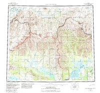
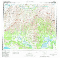
1956 Map of Baird Mountains
USGS Topo · Published 1988About this map
The Baird Mountains and Maiyumerak Mountains dominate this 1950s study of northwestern Alaska. The landscape is defined by the massive drainage systems of the Noatak River and Kobuk River, including the dramatic Grand Noatak Canyon and Noatah Canyon. This era represents a significant period of topographical recording, capturing the region just as large portions were being designated under the Noatak National Preserve and Kobuk Valley National Park. Small human outposts like Kiana and Klery Creek are noted alongside the Squirrel River Landing Strip, marking the essential role of bush aviation and river travel in this subarctic interior. The map also traces intricate water bodies such as Lake Mapsa, Lake Narvakrak, and Lake Tulugak, which serve as vital landmarks across the tundra and mountain passes.
Find a feature on this map
74 named features on this map. Tap any name to fly to it.
Don’t see what you’re looking for? This feature index may not catch every label — zoom into the map to look around manually.
Map Details
Editions of this 1956 Baird Mountains Map
7 editions found

Other maps of this area

1951 · De Long Mountains
USGS Topo · 1:250,000

1951 · Baird Mountains
USGS Topo · 1:250,000

1951 · Selawik
USGS Topo · 1:250,000

1951 · Shungnak
USGS Topo · 1:250,000

1951 · Noatak
USGS Topo · 1:250,000

1951 · Kotzebue
USGS Topo · 1:250,000

1951 · Howard Pass
USGS Topo · 1:250,000

1951 · Ambler River
USGS Topo · 1:250,000

1951 · Misheguk Mountain
USGS Topo · 1:250,000

1951 · Kotzebue D-1
USGS Topo · 1:63,360