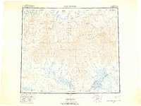
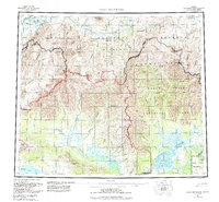
1956 Map of Baird Mountains
USGS Topo · Published 1965About this map
The Baird Mountains and Maiyumerak Mountains dominate this mid-century survey of the Northwest Arctic, revealing a complex drainage system between the Noatak River and the Squirrel River. The landscape is defined by its dramatic relief, featuring landmarks like Windy Bluff and the Noatak Canyon, alongside high points such as Nakolik Mtn and Kanaktok Mountain. This era of mapping shows the region's reliance on seasonal travel, evidenced by the Winter Trail cutting through the southern portion of the sheet near the Kiana Hills. Numerous water bodies, including Lake Kangilipak and the Grand Canyon River, are documented in detail, providing a snapshot of the hydrological network before significant modern changes. The intricate network of creeks like Aklumayuak Creek and Kungukrak Creek illustrates the remote and pristine nature of this Alaskan interior during the 1950s.
Find a feature on this map
60 named features on this map. Tap any name to fly to it.
Don’t see what you’re looking for? This feature index may not catch every label — zoom into the map to look around manually.
Map Details
Editions of this 1956 Baird Mountains Map
7 editions found

Other maps of this area

1951 · De Long Mountains
USGS Topo · 1:250,000

1951 · Baird Mountains
USGS Topo · 1:250,000

1951 · Selawik
USGS Topo · 1:250,000

1951 · Shungnak
USGS Topo · 1:250,000

1951 · Noatak
USGS Topo · 1:250,000

1951 · Kotzebue
USGS Topo · 1:250,000

1951 · Howard Pass
USGS Topo · 1:250,000

1951 · Ambler River
USGS Topo · 1:250,000

1951 · Misheguk Mountain
USGS Topo · 1:250,000

1951 · Kotzebue D-1
USGS Topo · 1:63,360