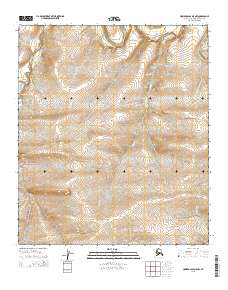
2015 Map of Howard Pass D-5 NW
USGS Topo · Published 2015About this map
The Colville River flows across the northern reaches of this Arctic landscape, marking a significant drainage path in the remote Howard Pass region. This topographical study captures the complex hydrological network where the Nuka River and the meandering Mitten Creek converge toward the main river valley. The terrain is defined by high-elevation ridges and deep-cut stream beds typical of the North Slope, illustrating the natural watercourses that have shaped the land long before human infrastructure reached this corner of Alaska. The map provides a detailed look at the township and range divisions, including t5s r30w and t6s r29w, which delineate the vast, uninhabited wilderness. This record is essential for understanding the geomorphology of the Brooks Range foothills and tracing the paths of Arctic waterways during the early 21st century.
Find a feature on this map
7 named features on this map. Tap any name to fly to it.
Don’t see what you’re looking for? This feature index may not catch every label — zoom into the map to look around manually.
Map Details
Editions of this 2015 Howard Pass D-5 NW Map
This is the sole edition of this map. No revisions or reprints were ever made.
Other maps of this area

1951 · Utukok River
USGS Topo · 1:250,000

1951 · Lookout Ridge
USGS Topo · 1:250,000

1951 · Howard Pass
USGS Topo · 1:250,000

1951 · Misheguk Mountain
USGS Topo · 1:250,000

1956 · Lookout Ridge
USGS Topo · 1:250,000

1956 · Howard Pass
USGS Topo · 1:250,000

1956 · Misheguk Mountain
USGS Topo · 1:250,000

1956 · Utukok River
USGS Topo · 1:250,000

1965 · Utukok River
USGS Topo · 1:250,000
1984 · Howard Pass D-5
USGS Topo · 1:63,360