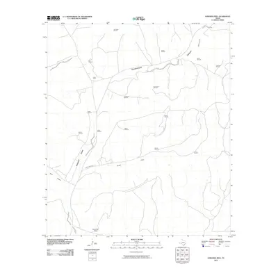
2010 Map of Howards Well
USGS Topo · Published 2010About this map
Pierce Ranch stands as a focal point of settlement in this arid reach of West Texas, where the management of water defines the human footprint on the land. A vast network of named water-lifting infrastructure, including Star Divide Windmill, Odom Windmill, and Middle Windmill, is distributed across the territory to support livestock and habitation. The landscape is deeply etched by ephemeral drainage systems like Howard Draw and Sevenmile Draw, which serve as the primary topographical markers in an area defined by wide canyons such as Government Canyon. This 2010 survey by the U.S. Geological Survey illustrates a modern continuation of historic ranching practices, where scattered outposts and named windmills like Yegua Windmill and Sulphur Windmill represent the sparse but vital points of activity within the rugged Crockett County terrain.
Find a feature on this map
20 named features on this map. Tap any name to fly to it.
Don’t see what you’re looking for? This feature index may not catch every label — zoom into the map to look around manually.
Map Details
Editions of this 2010 Howards Well Map
This is the sole edition of this map. No revisions or reprints were ever made.
Other maps of this area

1929 · Sheffield
USGS Topo · 1:125,000

1954 · Sonora
USGS Topo · 1:250,000

1958 · Sonora
USGS Topo · 1:250,000

1967 · Burnt Canyon
USGS Topo · 1:24,000

1967 · Hunt Ranch
USGS Topo · 1:24,000

1967 · Mitchell Canyon
USGS Topo · 1:24,000

1970 · Howards Well NE
USGS Topo · 1:24,000

1970 · Antone Canyon
USGS Topo · 1:24,000

1970 · Aermotor Draw
USGS Topo · 1:24,000

1970 · Howards Well
USGS Topo · 1:24,000