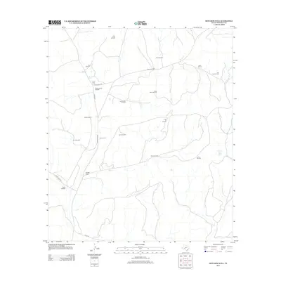
2012 Map of Howards Well
USGS Topo · Published 2012About this map
Howard Springs and the nearby Howards Well anchor this remote section of the Edwards Plateau, marking a critical water source in the arid West Texas landscape. Located in Crockett County, this area is defined by its deep canyons and dry draws, including Government Canyon, Scott Canyon, and Sowell Draw. The map illustrates the specialized infrastructure of Texas ranching, where numerous windmills like Star Divide Windmill, Odom Windmill, and Murrah Windmill provide essential water for livestock across the vast rangelands. The isolated Pierce Ranch sits at the junction of Ranch Road 2083 and Co Hwy 405, representing the primary human habitation in a territory where names like Government Water Hole Spring suggest the area's long history as a vital stop for travelers and surveyors navigating the rugged limestone terrain.
Find a feature on this map
25 named features on this map. Tap any name to fly to it.
Don’t see what you’re looking for? This feature index may not catch every label — zoom into the map to look around manually.
Map Details
Editions of this 2012 Howards Well Map
This is the sole edition of this map. No revisions or reprints were ever made.
Other maps of this area

1929 · Sheffield
USGS Topo · 1:125,000

1954 · Sonora
USGS Topo · 1:250,000

1958 · Sonora
USGS Topo · 1:250,000

1967 · Burnt Canyon
USGS Topo · 1:24,000

1967 · Hunt Ranch
USGS Topo · 1:24,000

1967 · Mitchell Canyon
USGS Topo · 1:24,000

1970 · Howards Well NE
USGS Topo · 1:24,000

1970 · Antone Canyon
USGS Topo · 1:24,000

1970 · Aermotor Draw
USGS Topo · 1:24,000

1970 · Howards Well
USGS Topo · 1:24,000