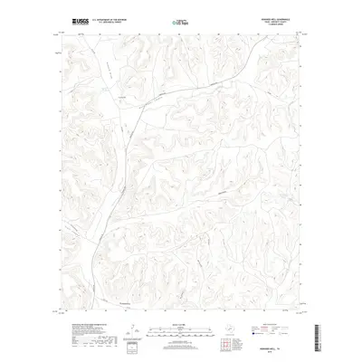
2019 Map of Howards Well
USGS Topo · Published 2019About this map
Howards Well serves as a focal point in this high-desert reach of Crockett County, where the desert landscape is deeply incised by a complex network of dry washes and canyons. The map illustrates a critical historical water source at Howard Springs and the Government Water Hole Spring, points of vital importance in an arid environment where surface water is scarce. The terrain is defined by the broad path of Howard Draw and the twisting route of Government Canyon, which dominate the central topography.
Find a feature on this map
18 named features on this map. Tap any name to fly to it.
Don’t see what you’re looking for? This feature index may not catch every label — zoom into the map to look around manually.
Map Details
Editions of this 2019 Howards Well Map
This is the sole edition of this map. No revisions or reprints were ever made.
Other maps of this area

1929 · Sheffield
USGS Topo · 1:125,000

1954 · Sonora
USGS Topo · 1:250,000

1958 · Sonora
USGS Topo · 1:250,000

1967 · Burnt Canyon
USGS Topo · 1:24,000

1967 · Hunt Ranch
USGS Topo · 1:24,000

1967 · Mitchell Canyon
USGS Topo · 1:24,000

1970 · Howards Well NE
USGS Topo · 1:24,000

1970 · Antone Canyon
USGS Topo · 1:24,000

1970 · Aermotor Draw
USGS Topo · 1:24,000

1970 · Howards Well
USGS Topo · 1:24,000