
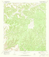
1970 Map of Howards Well SW
USGS Topo · Published 1973About this map
Watson Ranch and Kincaid Ranch represent the sparse human footprint in this corner of West Texas during the late 1960s. The landscape is defined by an intricate network of dry washes and canyons that carve through the limestone terrain, including the prominent Howard Draw and Sevenmile Draw. The map documents early energy exploration in the region, noting a Gas Well, Oil Well, and a Drill Hole scattered among the draws. An Indefinite Boundary marks the dividing line between Crockett and Val Verde counties, while a prominent Pipeline cuts across the northern canyons, signifying the industrial infrastructure emerging within this ranching country. The naming of features like Jesus Canyon and Dog Canyon reflects the local vernacular of the plateau's rugged topography.
Find a feature on this map
16 named features on this map. Tap any name to fly to it.
Don’t see what you’re looking for? This feature index may not catch every label — zoom into the map to look around manually.
Map Details
Editions of this 1970 Howards Well SW Map
This is the sole edition of this map. No revisions or reprints were ever made.
Other maps of this area

1954 · Sonora
USGS Topo · 1:250,000

1958 · Sonora
USGS Topo · 1:250,000

1970 · Howards Well NE
USGS Topo · 1:24,000

1970 · Antone Canyon
USGS Topo · 1:24,000

1970 · Aermotor Draw
USGS Topo · 1:24,000

1970 · Pandale
USGS Topo · 1:24,000

1970 · Steel Star Draw
USGS Topo · 1:24,000

1970 · Howards Well
USGS Topo · 1:24,000
1970 · Divide Well Draw
USGS Topo · 1:24,000
1970 · Prince Albert Draw
USGS Topo · 1:24,000