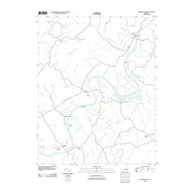
2010 Map of Howardsville
USGS Topo · Published 2010About this map
The James River defines the geography of this central Virginia landscape, carving a deep arc through the terrain of Nelson and Buckingham Counties. At the northern bend, the village of Howardsville sits near the confluence with the Rockfish River, served by the Howardsville Post Office and connected to the hinterlands via the Howardsville Tpke. The river is punctuated by several prominent landforms, including Dog Island, Buford Island, and Sycamore Island, illustrating the dynamic nature of this waterway.
Find a feature on this map
55 named features on this map. Tap any name to fly to it.
Don’t see what you’re looking for? This feature index may not catch every label — zoom into the map to look around manually.
Map Details
Editions of this 2010 Howardsville Map
This is the sole edition of this map. No revisions or reprints were ever made.
Other maps of this area

1892 · Buckingham
USGS Topo · 1:125,000

1929 · Covesville
USGS Topo · 1:62,500

1935 · Covesville
USGS Topo · 1:62,500

1943 · Lovingston
USGS Topo · 1:62,500

1945 · Covesville
USGS Topo · 1:62,500

1946 · Lovingston
USGS Topo · 1:62,500

1947 · Roanoke
USGS Topo · 1:250,000

1959 · Roanoke
USGS Topo · 1:250,000

1961 · Shipman
USGS Topo · 1:62,500

1961 · Buckingham
USGS Topo · 1:62,500