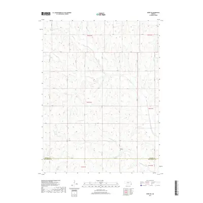
2017 Map of Howe SW
USGS Topo · Published 2017About this map
The rolling agricultural divide between Nemaha and Richardson counties defines this section of the Nebraska landscape. The terrain is intricately carved by several watercourses, most notably the winding paths of Muddy Cr, Little Muddy Cr, and the smaller Scotch Br. This drainage network suggests a landscape shaped by significant erosion, where the high ridges are partitioned by a systematic grid of section roads like 727 Rd and 635 Ave.
Find a feature on this map
27 named features on this map. Tap any name to fly to it.
Don’t see what you’re looking for? This feature index may not catch every label — zoom into the map to look around manually.
Map Details
Editions of this 2017 Howe SW Map
This is the sole edition of this map. No revisions or reprints were ever made.
Other maps of this area

1915 · Howe
USGS Topo · 1:62,500

1916 · Humboldt
USGS Topo · 1:62,500

1955 · Nebraska City
USGS Topo · 1:250,000

1955 · Lincoln
USGS Topo · 1:250,000

1957 · Nebraska City
USGS Topo · 1:250,000

1957 · Lincoln
USGS Topo · 1:250,000

1958 · Lincoln
USGS Topo · 1:250,000

1958 · Nebraska City
USGS Topo · 1:250,000

1965 · Table Rock
USGS Topo · 1:24,000
1965 · Tecumseh SE
USGS Topo · 1:24,000