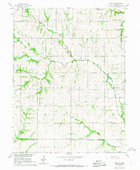
1966 Map of Howe SW
USGS Topo · Published 1967About this map
Muddy Creek and its tributary Little Muddy Creek carve a network of drainages through this rural landscape along the Nemaha and Richardson County line in the mid-1960s. The region is defined by its small-scale community centers, where St Johns Ch and Pleasant View Ch served local families. The latter is situated alongside the Pleasant View Cem, providing a focal point for genealogical research in this part of Southeast Nebraska.
Find a feature on this map
18 named features on this map. Tap any name to fly to it.
Don’t see what you’re looking for? This feature index may not catch every label — zoom into the map to look around manually.
Map Details
Editions of this 1966 Howe SW Map
This is the sole edition of this map. No revisions or reprints were ever made.
Other maps of this area

1915 · Howe
USGS Topo · 1:62,500

1916 · Humboldt
USGS Topo · 1:62,500

1955 · Nebraska City
USGS Topo · 1:250,000

1955 · Lincoln
USGS Topo · 1:250,000

1957 · Nebraska City
USGS Topo · 1:250,000

1957 · Lincoln
USGS Topo · 1:250,000

1958 · Lincoln
USGS Topo · 1:250,000

1958 · Nebraska City
USGS Topo · 1:250,000

1965 · Table Rock
USGS Topo · 1:24,000
1965 · Tecumseh SE
USGS Topo · 1:24,000