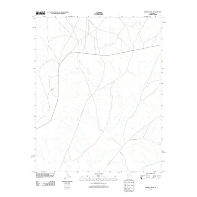
2011 Map of Howell Mesa
USGS Topo · Published 2011About this map
Howell Mesa dominates the western portion of this high-desert landscape in Coconino County, characterized by a sparse network of essential reservation roads. This 2011 survey illustrates the modern transportation corridors within the region, specifically centered on the Hopi Reservation Rd. The map tracks several secondary routes branching off from the main artery, including Indian Rte 6660 and Indian Rte 7. To the south and east, the desert floor is crisscrossed by Indian Rte 3, Indian Rte 9, and Indian Rte 13. The absence of dense settlements highlights the vast, open character of the mesa country during the early 21st century, focusing purely on the relationship between terrain and the rural road infrastructure that connects these remote points.
Find a feature on this map
7 named features on this map. Tap any name to fly to it.
Don’t see what you’re looking for? This feature index may not catch every label — zoom into the map to look around manually.
Map Details
Editions of this 2011 Howell Mesa Map
This is the sole edition of this map. No revisions or reprints were ever made.
Other maps of this area

1883 · Marsh Pass
USGS Topo · 1:250,000

1883 · Tusayan
USGS Topo · 1:250,000

1886 · Tusayan
USGS Topo · 1:250,000

1892 · Marsh Pass
USGS Topo · 1:250,000

1947 · Flagstaff
USGS Topo · 1:250,000

1954 · Flagstaff
USGS Topo · 1:250,000

1956 · Marble Canyon
USGS Topo · 1:250,000

1958 · Flagstaff
USGS Topo · 1:250,000

1959 · Marble Canyon
USGS Topo · 1:250,000

1960 · Flagstaff
USGS Topo · 1:250,000