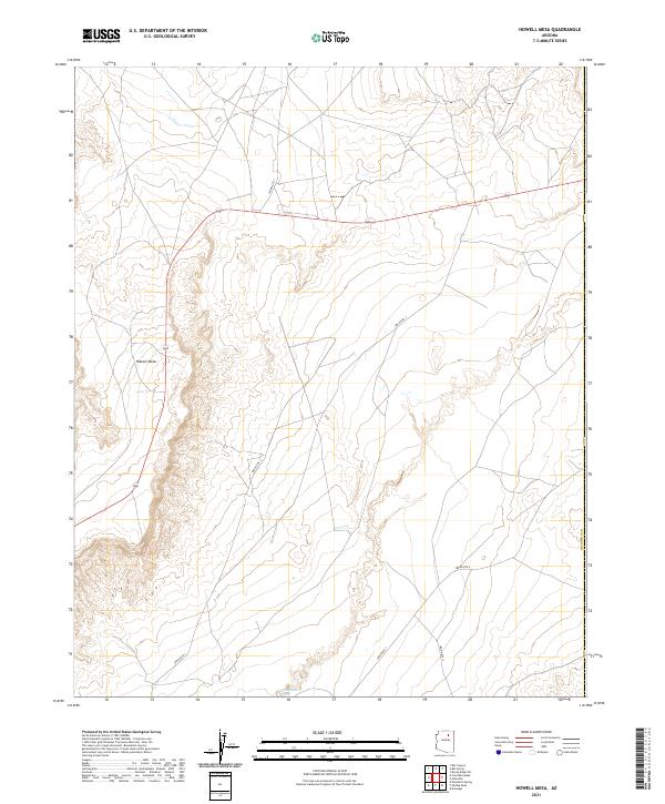
2021 Map of Howell Mesa
USGS Topo · Published 2021About this map
Howell Mesa rises as the dominant topographic feature in this high desert landscape, defining the local relief across several townships. The land is marked by a network of regional corridors including Indian Rte 7 and Indian Rte 3, which facilitate travel through this part of the Navajo Nation. At the southern edge of the survey, the Dinnebito Wash carves a path through the terrain, indicating the seasonal drainage patterns essential to the local environment. This modern data from the Coconino Co border region captures the area as it is managed today, where traditional land use meets modern infrastructure. The spatial organization is structured by the Public Land Survey System, shown here through the divisions of t30n r14e and adjacent tracts, providing a clear view of the geopolitical boundaries in this part of northern Arizona.
Find a feature on this map
11 named features on this map. Tap any name to fly to it.
Don’t see what you’re looking for? This feature index may not catch every label — zoom into the map to look around manually.
Map Details
Editions of this 2021 Howell Mesa Map
This is the sole edition of this map. No revisions or reprints were ever made.
Other maps of this area

1883 · Marsh Pass
USGS Topo · 1:250,000

1883 · Tusayan
USGS Topo · 1:250,000

1886 · Tusayan
USGS Topo · 1:250,000

1892 · Marsh Pass
USGS Topo · 1:250,000

1947 · Flagstaff
USGS Topo · 1:250,000

1954 · Flagstaff
USGS Topo · 1:250,000

1956 · Marble Canyon
USGS Topo · 1:250,000

1958 · Flagstaff
USGS Topo · 1:250,000

1959 · Marble Canyon
USGS Topo · 1:250,000

1960 · Flagstaff
USGS Topo · 1:250,000