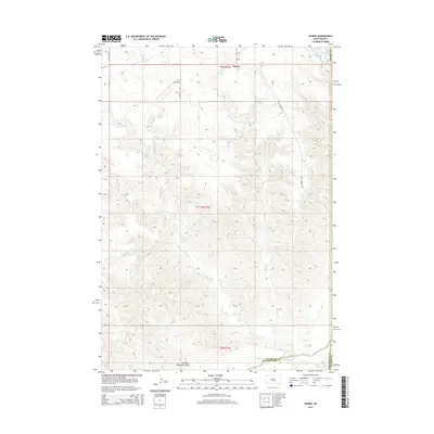
2015 Map of Howes
USGS Topo · Published 2015About this map
Howes sits as a central point of reference in this landscape defined by the drainage networks of the Cheyenne River and its numerous tributaries. The terrain is marked by intricate watercourses like Narcelle Cr, Negro Cr, and Luis Cr, which cut through the high plains. In the southern reaches, Whimmer Draw and Timber Cr lead toward the river valley, while the borders of Meade Co, Pennington Co, and Haakon Co converge in the southeast corner. The survey shows a sparsely populated region where life and transport follow the land's natural contours, connected by a simple network of rural routes such as Antelope Rd and Four Corners Rd. This 2015 study provides a clear view of the ranching and agricultural geography of western South Dakota, illustrating how modern administrative boundaries intersect with long-established natural drainage patterns.
Find a feature on this map
21 named features on this map. Tap any name to fly to it.
Don’t see what you’re looking for? This feature index may not catch every label — zoom into the map to look around manually.
Map Details
Editions of this 2015 Howes Map
This is the sole edition of this map. No revisions or reprints were ever made.
Other maps of this area

1953 · Rapid City
USGS Topo · 1:250,000

1954 · Pierre
USGS Topo · 1:250,000

1955 · Bridger
USGS Topo · 1:24,000

1955 · Pedro
USGS Topo · 1:24,000

1955 · Pedro NW
USGS Topo · 1:24,000

1955 · Howes
USGS Topo · 1:24,000

1955 · Hilland NW
USGS Topo · 1:24,000

1957 · Rapid City
USGS Topo · 1:250,000

1958 · Pierre
USGS Topo · 1:250,000

1982 · Dead Horse Draw
USGS Topo · 1:24,000