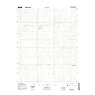
2014 Map of Hualapai Tank
USGS Topo · Published 2014About this map
The water management systems of high-desert Coconino County define this 2014 survey, highlighting the critical role of livestock and wildlife tanks in a landscape marked by drainage basins and arid draws. Hualapai Tank and the uniquely named Tank Number Four and One-Half serve as focal points for local land use, situated near the headwaters of Twin Tank Draw. This topographic study provides a snapshot of the region's ranching infrastructure and hydrological features, including the course of Sand Cr and Black Tank Wash as they carve through the plateau. Access across this remote terrain is delineated by established routes such as Camp 5 Rd and Supai Rd, which navigate the township lines of T30N R4W and T29N R4W. The map captures a moment in the modern era before significant further development, preserving the placement of named tanks like Tank Number Twenty within their original environmental context.
Find a feature on this map
12 named features on this map. Tap any name to fly to it.
Don’t see what you’re looking for? This feature index may not catch every label — zoom into the map to look around manually.
Map Details
Editions of this 2014 Hualapai Tank Map
This is the sole edition of this map. No revisions or reprints were ever made.
Other maps of this area

1886 · Chino
USGS Topo · 1:250,000

1886 · Kaibab
USGS Topo · 1:250,000

1891 · Chino
USGS Topo · 1:250,000

1948 · Williams
USGS Topo · 1:250,000

1953 · Grand Canyon
USGS Topo · 1:250,000

1954 · Williams
USGS Topo · 1:250,000

1956 · Williams
USGS Topo · 1:250,000

1957 · Grand Canyon
USGS Topo · 1:250,000

1958 · Grand Canyon
USGS Topo · 1:250,000

1960 · Williams
USGS Topo · 1:250,000