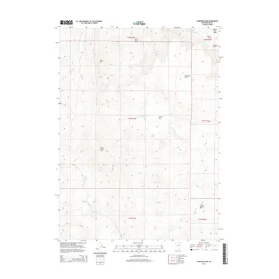
2014 Map of Hubbard Basin
USGS Topo · Published 2014About this map
The high desert landscape of the Salmon River Range defines this portion of Elko County, where the terrain transitions from rugged peaks to broad basins. Hubbard Basin and Lower Hubbard Basin dominate the central and southeastern topography, punctuated by distinctive flat-topped mesas such as Little Devils Table and Big Devils Table. The area's hydrology is marked by numerous vital water sources essential for survival in this arid environment, including Twin Lodge Spring, Antelope Spring, and Log Spring. Human presence is evidenced primarily by the cattle-ranching infrastructure of Corner Reservoir and the winding path of CR-755. From the elevations of Black Mtn and Cold Springs Mtn, the drainage of Salmon Falls Cr and Devil Cr carves through the earth, illustrating the natural water management of the Great Basin.
Find a feature on this map
26 named features on this map. Tap any name to fly to it.
Don’t see what you’re looking for? This feature index may not catch every label — zoom into the map to look around manually.
Map Details
Editions of this 2014 Hubbard Basin Map
This is the sole edition of this map. No revisions or reprints were ever made.
Other maps of this area

1955 · Wells
USGS Topo · 1:250,000

1957 · Contact
USGS Topo · 1:62,500

1957 · Elk Mountain
USGS Topo · 1:62,500

1958 · Wells
USGS Topo · 1:250,000

1961 · Wells
USGS Topo · 1:250,000

1968 · Hubbard Basin
USGS Topo · 1:24,000

1968 · Henry
USGS Topo · 1:24,000
1968 · Harris Canyon
USGS Topo · 1:24,000
1968 · Boies Reservoir
USGS Topo · 1:24,000
1968 · Stormy Peak
USGS Topo · 1:24,000