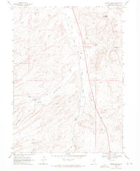
1968 Map of Harris Canyon
USGS Topo · Published 1972About this map
Union Pacific rail lines slice through this high-desert corridor of northeastern Nevada, following the drainage of Willow Creek as it moves south toward the Shores siding. The landscape is defined by its intermittent water sources and ranching infrastructure, evidenced by the Harris Canyon Dam and several isolated wells such as Dry Basin Well and Well. To the east, the terrain rises toward Rocky Peak and the expanse of Eagle Flat, while the western portion is etched by the seasonal flows of Jakes Creek and Harris Canyon Creek. The presence of several Gravel Pits and various benchmarks like BM 5675 suggests a landscape managed for both transport and local resource extraction. This late-sixties survey documents the intricate network of water management, including Mud Springs and Cold Springs Creek, necessary for maintaining operations in this arid ranching and transit district.
Find a feature on this map
27 named features on this map. Tap any name to fly to it.
Don’t see what you’re looking for? This feature index may not catch every label — zoom into the map to look around manually.
Map Details
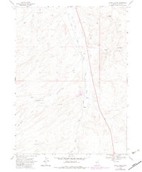
Editions of this 1968 Harris Canyon Map
2 editions found
Other maps of this area

1955 · Wells
USGS Topo · 1:250,000

1958 · Wells
USGS Topo · 1:250,000

1961 · Wells
USGS Topo · 1:250,000

1968 · Wilkins
USGS Topo · 1:24,000

1968 · Knoll Mountain
USGS Topo · 1:24,000

1968 · Hubbard Basin
USGS Topo · 1:24,000

1968 · Henry
USGS Topo · 1:24,000

1968 · Wine Cup Ranch
USGS Topo · 1:24,000

1968 · Blanchard Mtn
USGS Topo · 1:24,000
1968 · Loomis Mtn
USGS Topo · 1:24,000