
1968 Map of Wine Cup Ranch
USGS Topo · Published 1972About this map
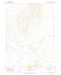
Wine Cup Ranch and Threemile Ranch anchor this high-desert landscape in Elko County, reflecting the region's enduring ranching heritage in the late 1960s. The terrain is defined by the prominent Windermere Hills to the south and a complex network of hydrologic features essential for survival in the arid Great Basin. The drainage of Thousand Springs Creek serves as a vital corridor through the valley, supported by numerous water sources including Wells (Hot), Springs (Hot), and Indian Spring. The map documents a sparsely populated area where human activity is primarily tied to livestock and resource management, indicated by various Borrow Pits and a winding Jeep Trail that navigates the slopes. This survey provides a precise record of water rights and land use, showing exactly where wells and springs were developed to support these remote cattle operations.
Find a feature on this map
22 named features on this map. Tap any name to fly to it.
Don’t see what you’re looking for? This feature index may not catch every label — zoom into the map to look around manually.
Map Details
Editions of this 1968 Wine Cup Ranch Map
2 editions found
Other maps of this area

1955 · Wells
USGS Topo · 1:250,000

1958 · Wells
USGS Topo · 1:250,000

1961 · Wells
USGS Topo · 1:250,000

1968 · Wilkins
USGS Topo · 1:24,000

1968 · Melandco
USGS Topo · 1:24,000

1968 · Knoll Mountain
USGS Topo · 1:24,000

1968 · Knoll Mountain SE
USGS Topo · 1:24,000

1968 · Wine Cup Ranch SE
USGS Topo · 1:24,000
1968 · Wine Cup Ranch SW
USGS Topo · 1:24,000
1968 · Harris Canyon
USGS Topo · 1:24,000