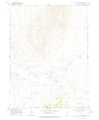
1968 Map of Wine Cup Ranch
USGS Topo · Published 1978About this map
Wine Cup Ranch sits at the heart of this high-desert landscape in Elko County, marking a center of local ranching activity in the late 1960s. The geography is defined by the broad Thousand Springs Valley, where the waters of Thousand Springs Creek flow toward the base of the Windermere Hills. This area is notable for its thermal activity, specifically the Springs (Hot) located near the main ranch complex, a critical water resource in an otherwise arid environment.
Find a feature on this map
13 named features on this map. Tap any name to fly to it.
Don’t see what you’re looking for? This feature index may not catch every label — zoom into the map to look around manually.
Map Details
Editions of this 1968 Wine Cup Ranch Map
2 editions found
Other maps of this area

1955 · Wells
USGS Topo · 1:250,000

1958 · Wells
USGS Topo · 1:250,000

1961 · Wells
USGS Topo · 1:250,000

1968 · Wilkins
USGS Topo · 1:24,000

1968 · Melandco
USGS Topo · 1:24,000

1968 · Knoll Mountain
USGS Topo · 1:24,000

1968 · Knoll Mountain SE
USGS Topo · 1:24,000

1968 · Wine Cup Ranch SE
USGS Topo · 1:24,000

1968 · Wine Cup Ranch
USGS Topo · 1:24,000
1968 · Wine Cup Ranch SW
USGS Topo · 1:24,000