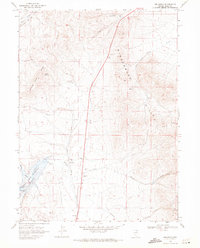
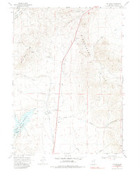
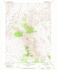
1968 Map of Melandco
USGS Topo · Published 1971About this map
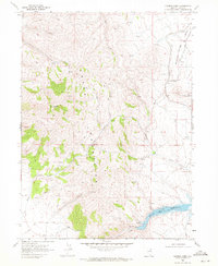
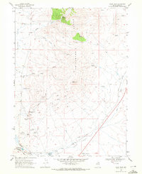
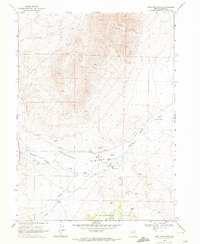
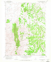
The Union Pacific line cuts through this high desert corridor, providing a vital transportation link past the settlement of Melandco. In this arid landscape, water management and topographic obstacles dictate the pattern of human activity. The western edge of the Windermere Hills meets the high flats where the Bishop Creek Reservoir sits, contained by the Berren Dam. This reservoir serves as a critical hydrological node for the surrounding rangeland, capturing flow from Willow Creek and Bishop Creek. Navigating the terrain relies on established routes like the Bishop Trail and various Jeep Trails that traverse the gaps between Summer Camp Ridge and the prominent HD Summit. The map captures a moment in the late 1960s when the cattle-ranching infrastructure of Thousand Springs Valley remained centered on these reliable water sources and the steady rhythm of the railroad.
Find a feature on this map
23 named features on this map. Tap any name to fly to it.
Don’t see what you’re looking for? This feature index may not catch every label — zoom into the map to look around manually.
Map Details
Editions of this 1968 Melandco Map
2 editions found
Other maps of this area

1955 · Wells
USGS Topo · 1:250,000

1958 · Wells
USGS Topo · 1:250,000

1961 · Wells
USGS Topo · 1:250,000
1968 · Wilkins
USGS Topo · 1:24,000
1968 · Holborn
USGS Topo · 1:24,000
1968 · Wells Peak
USGS Topo · 1:24,000
1968 · Summer Camp
USGS Topo · 1:24,000
1968 · Oxley Peak
USGS Topo · 1:24,000
1968 · Wine Cup Ranch
USGS Topo · 1:24,000
1968 · Wine Cup Ranch SW
USGS Topo · 1:24,000