
1968 Map of Holborn
USGS Topo · Published 1971About this map
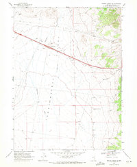
Southern Pacific Railroad tracks bisect this high-desert basin, marking the primary corridor of transport and communication through Elko County during the late 1960s. The landscape is defined by the broad Independence Valley, flanked by the rising slopes of the Windermere Hills to the northwest and the Pequop Mts to the east. Small railway-related settlements like Holborn and Fenelon anchor the rail line, while an Old Railroad Grade traces an earlier alignment of the route nearby. Water remains a critical element for ranching and transit in this arid environment, evidenced by scattered sources such as Independence Creek, Ralphs Spring, and the Independence Valley Well. A network of Jeep Trails provides access to the higher elevations, where drainage features like Deadman Creek carve through the foothills.
Find a feature on this map
20 named features on this map. Tap any name to fly to it.
Don’t see what you’re looking for? This feature index may not catch every label — zoom into the map to look around manually.
Map Details
Editions of this 1968 Holborn Map
This is the sole edition of this map. No revisions or reprints were ever made.
Other maps of this area

1955 · Wells
USGS Topo · 1:250,000

1958 · Wells
USGS Topo · 1:250,000

1961 · Wells
USGS Topo · 1:250,000

1968 · Moor Summit
USGS Topo · 1:24,000

1968 · Melandco
USGS Topo · 1:24,000

1968 · Pequop
USGS Topo · 1:24,000
1968 · Pequop Summit SW
USGS Topo · 1:24,000

1968 · Wells Peak
USGS Topo · 1:24,000
1968 · Pequop Summit
USGS Topo · 1:24,000

1968 · Wine Cup Ranch SE
USGS Topo · 1:24,000