
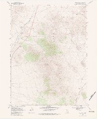
1968 Map of Wells Peak
USGS Topo · Published 1971About this map
Wells Peak stands as the central landmark in this Elko County landscape, anchoring the northern reaches of the Windermere Hills. The late 1960s terrain is defined by a critical corridor of western transportation, where the tracks of the Southern Pacific and Union Pacific railroads run parallel through the high desert. This infrastructure highlights the historical importance of the region as a transit artery across the Great Basin.
Find a feature on this map
15 named features on this map. Tap any name to fly to it.
Don’t see what you’re looking for? This feature index may not catch every label — zoom into the map to look around manually.
Map Details
Editions of this 1968 Wells Peak Map
2 editions found
Other maps of this area

1955 · Wells
USGS Topo · 1:250,000

1958 · Wells
USGS Topo · 1:250,000

1961 · Wells
USGS Topo · 1:250,000

1968 · Moor Summit
USGS Topo · 1:24,000

1968 · Holborn
USGS Topo · 1:24,000

1968 · Wells
USGS Topo · 1:24,000

1968 · Melandco
USGS Topo · 1:24,000
1968 · Pequop Summit SW
USGS Topo · 1:24,000

1968 · Summer Camp
USGS Topo · 1:24,000
1968 · Oxley Peak
USGS Topo · 1:24,000